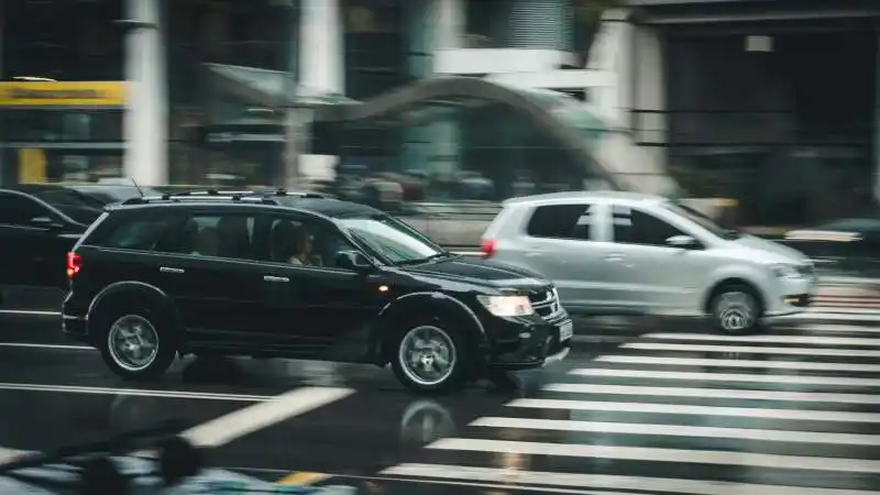
Road conditions play a crucial role in the daily lives of drivers and city planners alike. For drivers, knowing the current state of the roads can help them avoid traffic congestion, accidents, and other hazards. For city planners, real-time road condition updates provide valuable data that can be used to improve road infrastructure and make informed decisions. In Vancouver, real-time road condition updates have become an essential tool for both drivers and city planners.
Vancouver’s real-time road condition updates provide drivers with up-to-date information on traffic congestion, accidents, road closures, and other important factors that can affect their commute. This information is gathered from various sources, including traffic cameras, sensors embedded in the roads, and reports from law enforcement and transportation agencies. By accessing this information, drivers can make informed decisions about their routes and avoid potential delays or hazards.
Key Takeaways
- Real-time road condition updates provide valuable information for drivers in Vancouver.
- Commuters benefit from real-time updates by avoiding traffic and planning their routes more efficiently.
- Accessing real-time road condition updates is easy through various online platforms and mobile apps.
- Real-time road condition data helps city planners improve road infrastructure and safety.
- Technology plays a crucial role in delivering real-time road condition information to drivers.
How Real-Time Updates Help Drivers Navigate Vancouver’s Roads
Real-time updates have revolutionized the way drivers navigate Vancouver’s roads. By providing accurate and timely information about traffic conditions, accidents, and road closures, these updates help drivers plan their routes more efficiently and avoid unnecessary delays.
For example, if there is a major accident on a particular route, real-time updates will alert drivers to the situation and provide alternative routes to bypass the congestion. This not only saves drivers time but also reduces frustration and stress. Additionally, real-time updates can help drivers avoid areas with poor road conditions due to weather or construction work.
The Benefits of Real-Time Road Condition Information for Commuters
Commuters in Vancouver can greatly benefit from real-time road condition updates. These updates can save them time and money by helping them choose the most efficient routes for their daily commute.
By accessing real-time updates, commuters can avoid congested areas and choose alternative routes that are less crowded. This not only reduces travel time but also saves on fuel costs. Additionally, real-time updates can help commuters plan their departure times more effectively, avoiding peak traffic hours and further reducing travel time.
Furthermore, real-time updates can reduce stress and improve safety for commuters. By providing information about accidents, road closures, and other hazards, drivers can make informed decisions and avoid potentially dangerous situations. This not only improves the overall commuting experience but also contributes to a safer road environment.
How to Access Real-Time Road Condition Updates in Vancouver
| Source | Method | Frequency |
|---|---|---|
| City of Vancouver | Online map | Real-time |
| DriveBC | Website | Real-time |
| TransLink | Mobile app | Real-time |
| Google Maps | Mobile app | Real-time |
There are several ways for drivers to access real-time road condition updates in Vancouver. One of the most popular methods is through smartphone apps that provide real-time traffic information. These apps use GPS technology to track the user’s location and provide updates on traffic conditions in their area.
Another way to access real-time updates is through websites that specialize in providing traffic information. These websites often have interactive maps that show current traffic conditions, accidents, and road closures. Some websites even provide live video feeds from traffic cameras, allowing users to see the current state of the roads in real-time.
In addition to smartphone apps and websites, drivers can also receive real-time updates through radio broadcasts and electronic message signs on the roads. These methods are particularly useful for drivers who may not have access to a smartphone or internet connection while on the road.
Understanding the Data Behind Vancouver’s Real-Time Road Condition Reports
Real-time road condition reports in Vancouver are based on a variety of data sources. These sources include traffic cameras, sensors embedded in the roads, reports from law enforcement and transportation agencies, and even data from GPS-enabled smartphones.
Traffic cameras provide live video feeds of the roads, allowing operators to monitor traffic conditions in real-time. These cameras are strategically placed at key intersections and highway entrances/exits to capture a comprehensive view of the road network.
Sensors embedded in the roads collect data on vehicle speed, volume, and occupancy. This data is used to calculate travel times and detect traffic congestion. Additionally, sensors can detect adverse weather conditions such as ice or flooding, providing valuable information for drivers and city planners.
Reports from law enforcement and transportation agencies provide updates on accidents, road closures, and other incidents that may affect road conditions. These reports are often relayed to the public through various communication channels, including smartphone apps, websites, and electronic message signs.
Real-Time Road Condition Updates and Safety on Vancouver’s Roads

Real-time road condition updates have a significant impact on safety on Vancouver’s roads. By providing drivers with timely information about accidents, road closures, and other hazards, these updates help prevent accidents and reduce congestion.
For example, if there is an accident on a major highway, real-time updates will alert drivers to the situation and provide alternative routes. This helps prevent further accidents caused by rubbernecking or sudden lane changes. Additionally, real-time updates can help emergency responders reach the scene of an accident more quickly, potentially saving lives.
Furthermore, real-time updates can help reduce congestion by providing drivers with information about traffic conditions ahead. By choosing alternative routes or adjusting their departure times, drivers can help alleviate congestion and improve the overall flow of traffic.
How Real-Time Updates Help City Planners Improve Vancouver’s Road Infrastructure
Real-time road condition updates are not only beneficial for drivers but also for city planners. By analyzing the data provided by these updates, city planners can make informed decisions about road infrastructure improvements and traffic management strategies.
For example, if real-time updates consistently show congestion on a particular route during peak hours, city planners may consider widening the road or implementing traffic management measures such as signal timing adjustments or dedicated bus lanes. Similarly, if real-time updates show a high number of accidents at a specific intersection, city planners may consider installing traffic lights or roundabouts to improve safety.
Real-time updates also provide valuable data for transportation modeling and forecasting. By analyzing historical data on traffic patterns and congestion, city planners can identify trends and make predictions about future traffic conditions. This information can be used to guide long-term planning decisions and ensure that road infrastructure is designed to accommodate future growth.
The Role of Technology in Delivering Real-Time Road Condition Information
Technology plays a crucial role in delivering real-time road condition information to drivers and city planners. Advances in GPS technology, wireless communication, and data analytics have made it possible to collect, analyze, and disseminate real-time updates more efficiently than ever before.
GPS technology allows smartphones and other devices to accurately track the user’s location, making it possible to provide personalized real-time updates based on their current location. This technology also enables the collection of data on travel times, vehicle speed, and other factors that contribute to real-time road condition reports.
Wireless communication networks provide the infrastructure needed to transmit real-time updates to users in a timely manner. Whether through cellular networks or dedicated communication systems, these networks ensure that users receive updates quickly and reliably.
Data analytics techniques are used to process the vast amount of data collected from various sources and generate meaningful insights. Machine learning algorithms can analyze historical data to identify patterns and make predictions about future traffic conditions. This information is then used to generate real-time updates that are relevant and accurate.
Examples of Real-Time Road Condition Updates in Action in Vancouver
Real-time road condition updates have been successfully implemented in Vancouver, with several notable examples showcasing their effectiveness.
One such example is the use of real-time updates during major events or construction projects. When large events such as concerts or sporting events take place, traffic congestion can be a significant issue. By providing real-time updates on alternative routes and parking availability, drivers can avoid congested areas and find convenient parking options.
Another example is the use of real-time updates during severe weather events. Vancouver is known for its unpredictable weather, which can lead to hazardous road conditions. By providing real-time updates on road closures, icy conditions, and other weather-related hazards, drivers can make informed decisions and avoid potentially dangerous situations.
Furthermore, real-time updates have been instrumental in managing traffic flow during peak hours. By providing information on traffic conditions and suggesting alternative routes, real-time updates help alleviate congestion and improve the overall flow of traffic.
The Future of Real-Time Road Condition Updates in Vancouver and Beyond
The future of real-time road condition updates in Vancouver and beyond looks promising. Advances in technology, such as the Internet of Things (IoT) and connected vehicles, are expected to further enhance the accuracy and availability of real-time updates.
The IoT refers to the network of interconnected devices that collect and exchange data. In the context of real-time road condition updates, this could involve sensors embedded in vehicles that collect data on road conditions and transmit it to a central database. This data can then be used to generate real-time updates that are even more accurate and personalized.
Connected vehicles, which are equipped with wireless communication capabilities, can also play a significant role in delivering real-time updates. These vehicles can communicate with each other and with infrastructure such as traffic lights and road signs, providing drivers with real-time information on traffic conditions and potential hazards.
In addition to technological advancements, the future of real-time road condition updates will also be shaped by data analytics and artificial intelligence. These technologies can analyze large amounts of data to identify patterns, make predictions, and generate personalized recommendations for drivers.
Overall, the future of real-time road condition updates holds great potential for improving road safety, reducing congestion, and enhancing the overall commuting experience. As technology continues to advance, we can expect even more accurate and timely updates that will help drivers navigate Vancouver’s roads with ease.
If you’re interested in staying up-to-date with Vancouver road conditions live, you may also want to check out City Tow Truck’s privacy policy. Understanding how your personal information is handled and protected is crucial, especially when accessing real-time road updates. Additionally, City Tow Truck offers a range of towing services, including motorcycle towing. If you’re a motorcycle enthusiast navigating Vancouver’s roads, their specialized services might be of interest to you. Learn more about their motorcycle towing services here. For further information about City Tow Truck and their commitment to serving the community, you can visit their about page here.
FAQs
What is Vancouver Road Conditions Live?
Vancouver Road Conditions Live is a website that provides real-time updates on the current road conditions in Vancouver, Canada.
What kind of information does Vancouver Road Conditions Live provide?
Vancouver Road Conditions Live provides information on traffic congestion, accidents, road closures, construction, and other incidents that may affect the flow of traffic in Vancouver.
How often is the information on Vancouver Road Conditions Live updated?
The information on Vancouver Road Conditions Live is updated in real-time, meaning that it is constantly being updated as new incidents occur.
Is Vancouver Road Conditions Live free to use?
Yes, Vancouver Road Conditions Live is a free service that is available to anyone with an internet connection.
Can I access Vancouver Road Conditions Live on my mobile device?
Yes, Vancouver Road Conditions Live is accessible on mobile devices such as smartphones and tablets.
Is Vancouver Road Conditions Live affiliated with the City of Vancouver?
No, Vancouver Road Conditions Live is not affiliated with the City of Vancouver. It is an independent website that provides information on road conditions in the city.